Mt. Kearsarge (South) - April 5, 2009
Activity, photos, and report by Ken L.
Additional photos by Sandy R.
|
CURSED! |
| About a month before this hike, Your Webmaster and
Sandy went to visit a small cross-country ski area in Wilmot, NH.
Very little of the ski area was open due to diminishing snow. So
we decided to hike instead, and we went to Winslow State Park to head up
2937' Mt. Kearsarge via the Barlow Trail (1.8mi) to return the Winslow
Trail (1.1mi). Although the trail is great--and fairly easy for the
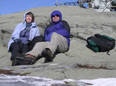
rewarding views--it was cold, the trail was full of ice, and the wind
was howling! If we look cold in the picture, it's only because of
the generous sun that we weren't icicles.
Your Webmaster ventured up into the observation tower that day but
could barely hold on.
So...We decided to try it again one more time now that it's
officially "springtime" (right?), and we ran into...MORE OF THE SAME! |
 |
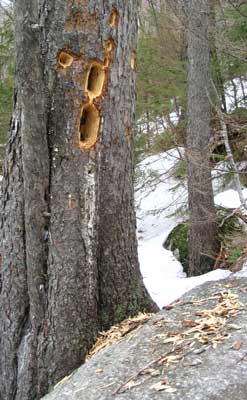
Not a good sign...
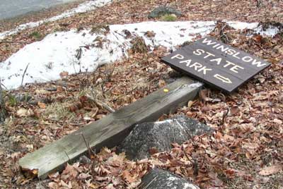
Hmmm...
We arrived at the turn onto the road leading to the gate for
Winslow State Park. Not only was the sign down, but snow still blocked
the way. So we parked, got our gear together, and hoofed it up the
snowy road to the picnic area inside the park. And, yes, we reminded
ourselves of a discussion earlier in the day about needing crampons or not.
Yeah, there'd probably be some snow and ice, but probably not a
lot...uh-huh. My spikey crampons were safely tucked away...in my
garage, of course.
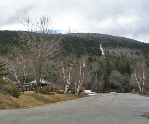
Mostly deserted this time of year, we did run into a few
people hiking or walking their dogs. Our intent was to head to the
Barlow Trail and wander up to the top of Mt. Kearsarge. Already it was
fairly windy, and the promises of temperatures in the 50s didn't
materialize. The sun could be seen once in a while, but by and large
it was hidden by a big cloud that sat right on top of the mountain...for the
day. And it looked like the mountain got a little bit of snow at
around the 2400' mark, as you can see in the above picture. Yep, the
curse was going to hold for Your Webmaster and Sandy...and this time we were
going to share it with Kris and DJ.
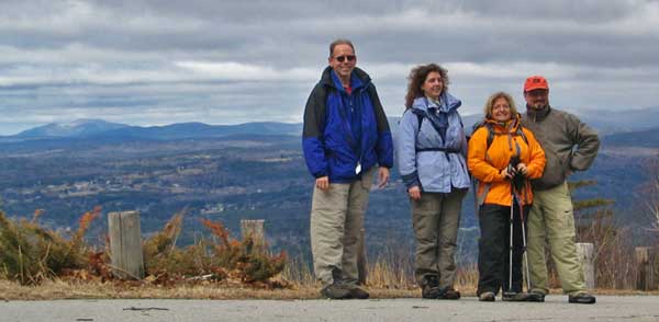
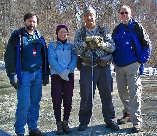
Your Webmaster, Sandy, Kris, DJ
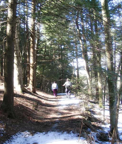
Undeterred, we grabbed a photo at the picnic area--quite
scenic, actually, for a walk up a road--and made our way to the Barlow Trail
trailhead. The Barlow Trail is 1.8 miles and doesn't have any long
steep sections, great for getting the bones moving if you've been
hibernating. Right at the start was plenty of snow. Generally
it's packed down this time of year, but on this trail we had a good amount
of slippery ice and even noted some post-holing, so it had a little bit of
everything. We noticed the new light accumulation of snow start at a
particular spot along the way.
Someone was hungry! |
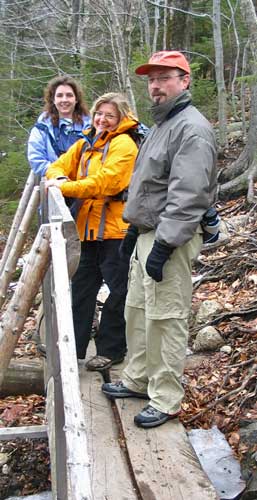
Sandy, Kris, and DJ on the bridge |
I'd say the amount of snow and ice on the trail was about 60%. It
was all snow and ice at the start, then there were plenty of bare spots in
the middle section of the trail, more ice nearer the top, then very little
when the trail broke out to the rocks near the summit. Already feeling
the gusts, we decided to stop short of the summit to grab some lunch and
enjoy the fabulous views to the east, which was out of the wind.
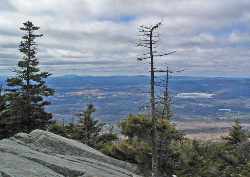
View to the west - the views from Mt. Kearsarge are
incredible
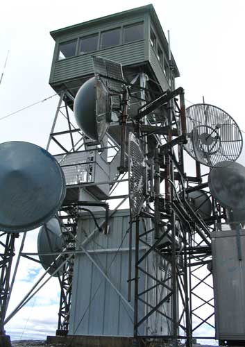 |
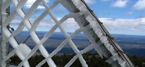
After our brief repast, we made our way to the summit where there is
an observation tower with an array of communications equipment. The
ice from the previous evening's snowfall was breaking off from the
antennas and platforms and was crashing to the ground. |
Your webmaster dodged the debris and wandered up to the
observation deck, only to be blown back by the heavy winds.
Nobody else decided to head up, preferring instead to duck
out of the wind and ponder the return trail...which itself proved to be a
bit of a challenge.
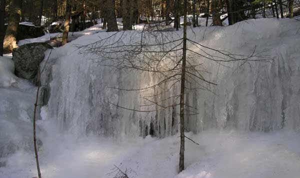
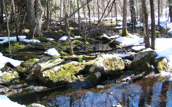
The ice along the Winslow Trail was a bit tricky,
considering our "real" crampons were, well, where they were doing the most
good: not on our feet and 100 miles away. Sandy had some YakTrax
with spikes, and Your Webmaster had a pair of the most basic YakTrax, so
they helped. However there's a large ice field along the trail, and
without decent crampons, it's tough to negotiate. The picture above
was from the last trip Sandy and Your Webmaster made to Mt. Kearsarge (the
incredible flowing ice is worth the trip alone), and the ice has diminished
since then, but it's still a bit tricky. Still we were able to skirt
the slippery areas and make our way back down to the picnic area and then
out of the park.
Safely back to the cars, we decided to grab some dins at a
local pub and warm up by the fire.
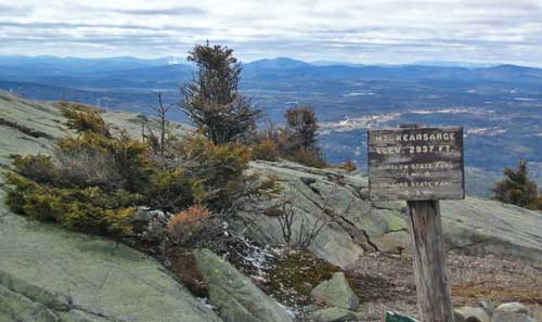
Mt. Kearsarge is a relatively light effort for some of the
best unobstructed views anywhere. You can see over into Vermont, up to
the White Mountains, well over to the flatter areas to the southeast.
During the warmer months the mountain is part a state park facility, but in
wintertime the area is closed...but open to you! Take I-89 to Rte. 11
and follow the signs. This time of year you park as close as you can
to the gate and walk in the rest of the way to the trailhead. Dress
for heavy gusty winds, and bring your crampons. :-) And prepare
yourself for some great views! |
Boxford State Forest Hike - March 14, 2009
Activity, photos, and report by Ken L.
The Boxford State Forest is a collection of state land and
other conservation land located not far from Rte 95 in the Boxford,
Massachusetts area. Once planned to host a NIKE missile defense
installation, the military's plans were shelved, and the land has now become
a collection of trails to be enjoyed by the public. There are no
facilities aside from one or two parking areas.
 |
Duane, Sarah, Michael S., and Your Webmaster met up at
the Sharpner's Pond Road parking lot on what turned out to be a sunny
Saturday. It was still a little on the cool side, the temperatures
not having shot up at 10am as they would by the end of the hike a few
hours later.
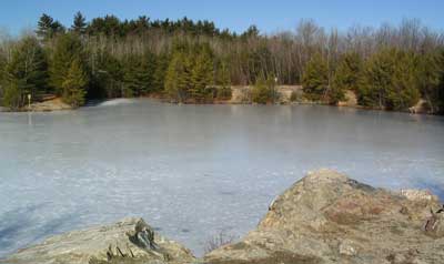
Not having been there before, we led Duane over to the
quarry, which was to be the site of the NIKE missiles, now full of water
still frozen over from the colder weather. |
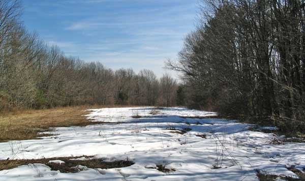
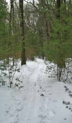
Our trek had us hitting a bit of a loop before reaching Bald Hill.
As expected, there was a bit of water around on the trails, but everything
was passable. The snow cover was odd, though, as you seemed to have no
snow, or you had half a foot or more. There was very little in
between; either the trail was bare, or you could have done some X-C skiing
with the snow depth. What snow there was had a soft and slightly
slushy texture to it, so keeping our footing wasn't a problem.
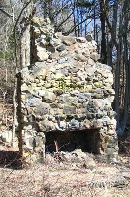 |
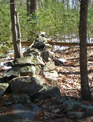
Over near Bald Hill is the site of the old
Russell-Hooper Farm, now little more than a few stone walls, a cellar
hole, a cistern, and a foundation with a chimney.
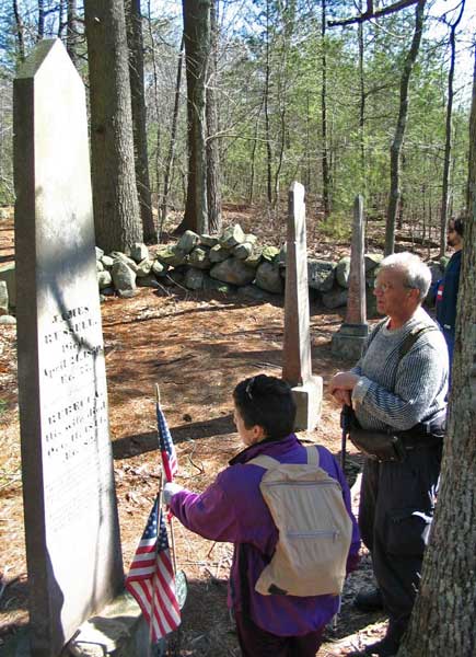
However the legacy of the Russell family lives on, as
these fine people reported for duty during the American Revolution, as
noted on the grave markers in the cemetery. Thank you...Your
spirit lives on in the hearts of Americans who intend to take back and
re-create the country you fought for over 200 years ago. |
After a brief stop at the Russell-Hooper site, we wandered
to the top of Bald Hill and bushwhacked down to the main trail to head on
out.
Bald Hill
Along the way was the large beaver dam...
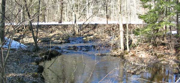
...that seems to grow higher every time we see it!
| It was a quiet walk in the Boxford State Forest on a
sunny, warm day during the last week of winter.
Your Webmaster was glad to have some fine company! |
 |
|
Estabrook Woods X-C Ski - February 7, 2009
Activity by Michael S.
Photos and report by Ken L.
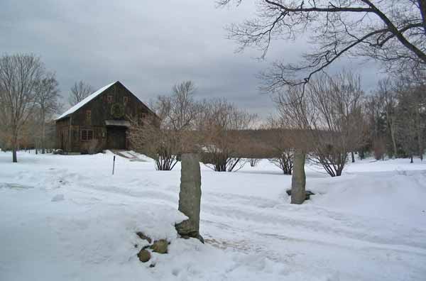
Barn at the entrance of Estabrook Woods
 |
Michael S. invited us all along for a few hours of
cross-country skiing at Estabrook Woods in Concord/Carlisle,
Massachusetts. Estabrook Woods is an area of woods and small ponds.
The area is full of history, most notably the Colonists marched along
Estabrook Road on the way to North Bridge in April 1775. And the
rest is certainly a heck of a history.
In addition to cellar holes, there is the site of an old lime kiln,
limestone being an important material for the Colonists, and it was
mined there in the woods. You can still see the sites where they
dug out the limestone (although not on this day with all the snow).
When you visit Estabrook Woods, please note that there are many dogs
around. In fact, I ran into a co-worker with his dog Jake! |
The day started out cold. In fact, the overnight low
was not very far above zero, but by the end of the day it was over 40
degrees. The snow conditions were outstanding. The trails had
already been packed down, so there was a solid base of probably a foot with
a little bit of tight powder at the top. There was a little bit of
grabbing on the bottom of the skis at around noontime, but after some clouds
showed up, the trails settled back down, enabling a great kick and
glide--and sometimes a kick wasn't even required! Normally you'd need
to drive far north for conditions this good, but not today!
 |
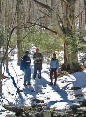
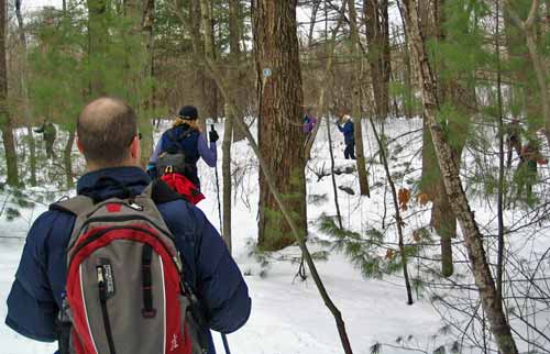
Many SubSIG people were there for the X-C ski outing.
Our group totaled 12 at the start. Our route took us from the
Estabrook Road entrance along Two Rod Road, then into Carlisle, then
some lefts here and there, and we found our way back to Estabrook Road
for a straight shot back to the parking lot.
Although mostly flat, there were some gentle hills that
provided a little bit of a variety. There's a great sledding hill
there in the woods as well...somewhere...:-) |
We paused for lunch after a few hours along the trail.
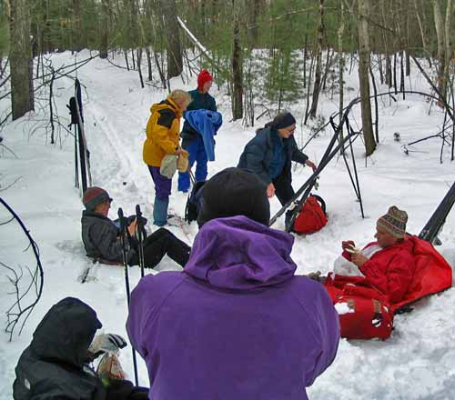
It was then that the group suddenly went to 13 people.
At the trail junction where we decided to stop, a lone skier appeared.
She looked at us and said she was lost and asked if we could help her out.
Immediately she recognized Joel, one of the SubSIG people, who just happened
to have a few maps printed out. So our group size went to 13 for a
while, and we helped our new friend find her way back to her car.
The trails were certainly busy...
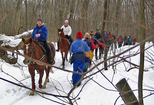
Sharing the trail
Well, I guess dogs aren't the only four-footed friends in
Estabrook Woods!
This was a fine day of cross-country skiing. Estabrook
Woods seems to be a worthy place to visit any time of year!
Information about Estabrook Woods is available
here
and here. Your
Webmaster could not find any "official" maps, but the "Walking Map" is about
the best and provides some historical information. There is a second
page to the Walking Map as provided by Joel of SubSIG, but Your Webmaster
could not find that on the 'net. It is probably there somewhere.
The second link has a GPS-mapped layout of the trails and other
things--neat! |
|