Tuckerman Ravine Hike and Ski - April 24, 2010
Activity, photos, and report by Randy C.
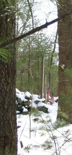
(Apologies for the poor photos, not Randy's fault...Your Webmaster's ancient
version of Word exported them like that.)
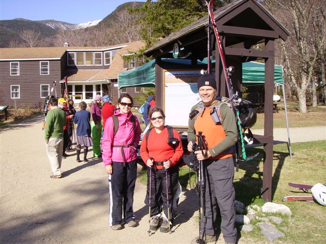
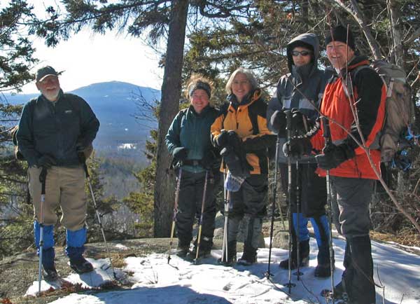
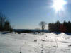
| The warmer and wetter spring of 2010 created green vista throughout New England and even in the White Mountain valleys. But up on the peaks, Tuckerman Ravine Dreams was still in full bloom. On April 24, Alison, Kelly and Randy made plans to visit the source. An early morning wake up and serious drive put us at the base of Mount Washington "about" 8 AM.
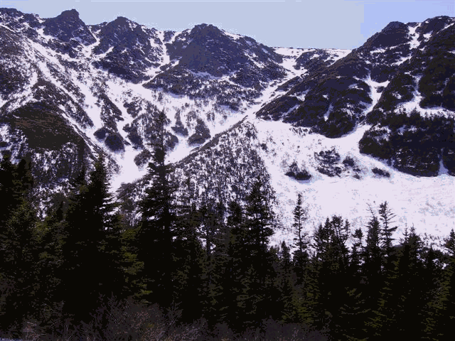
Yeah, that’s white on the peaks behind.
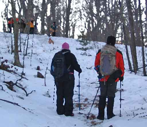
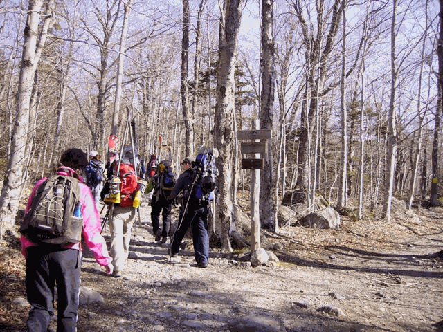
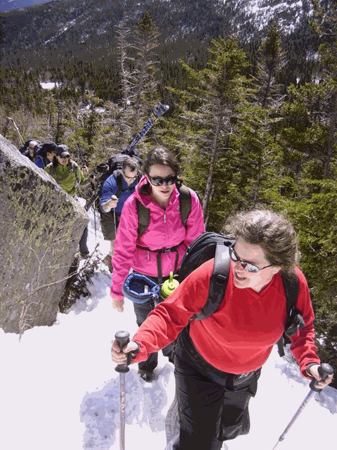
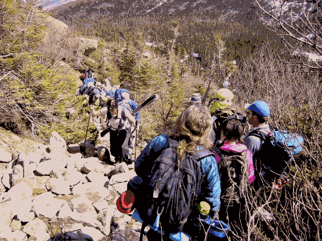
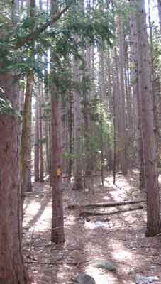
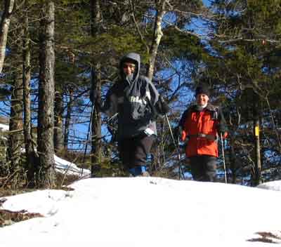
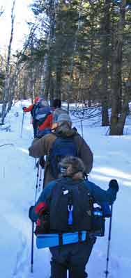
We followed a few friends up.
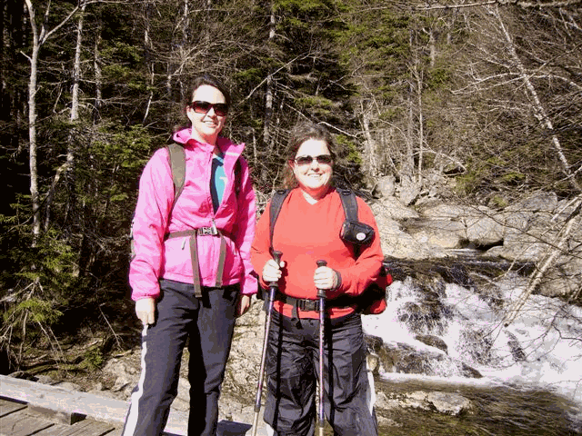
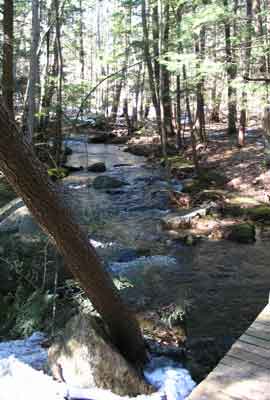
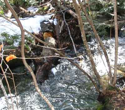
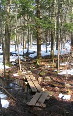
And took a slightly more posed picture at the first falls.
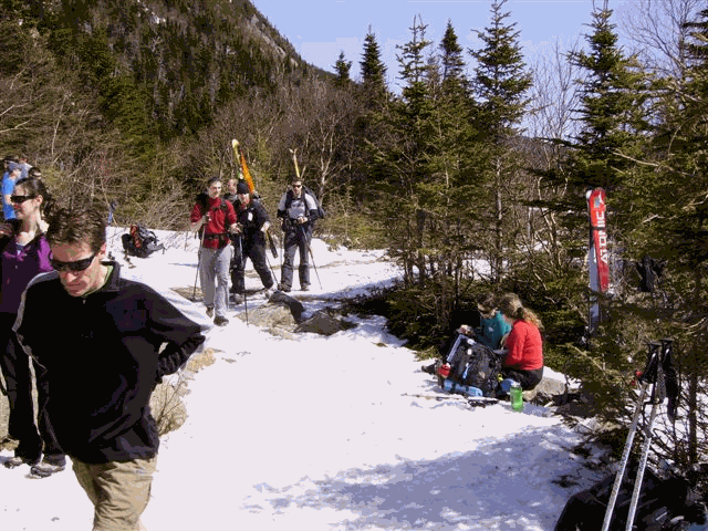
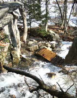
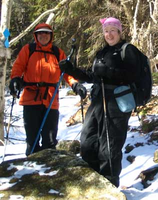
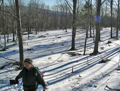
About an hour and 1500 vertical feet later we took a break at the third bridge. By this time the day was warming up and the heavy gear was going into packs.
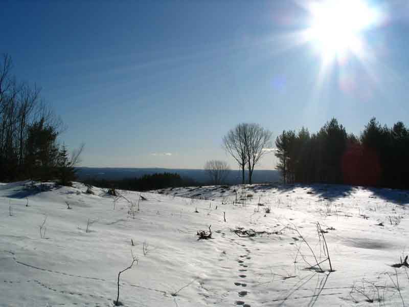
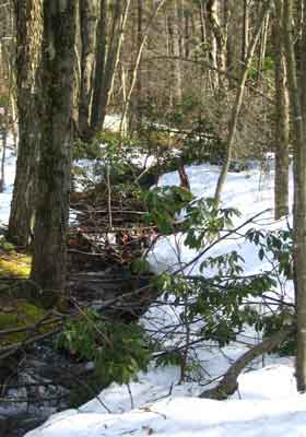
Its warm but the there is still a little snow left at 3000 feet.
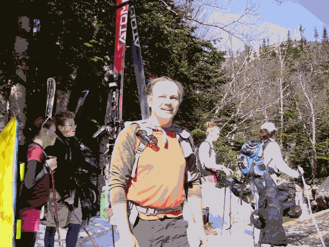
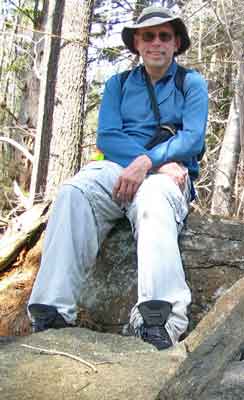
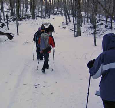
And someone got of hold of the trip leader’s camera
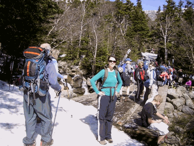
Alison takes in the first view of Tuckerman Ravine
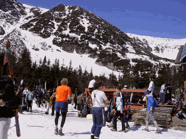
Kelly and Alison planning new ascent strategy at the Hermit Lake Hut
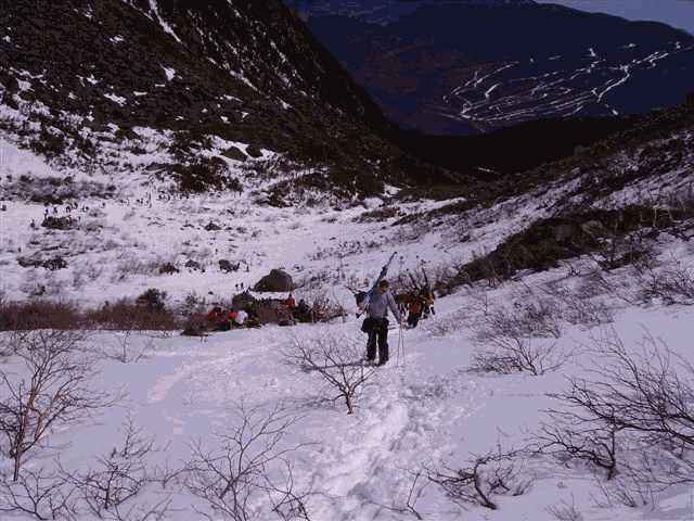
More of the "scene" at the hut – over 2000 people joined us on the trek today according to the Forest Service.
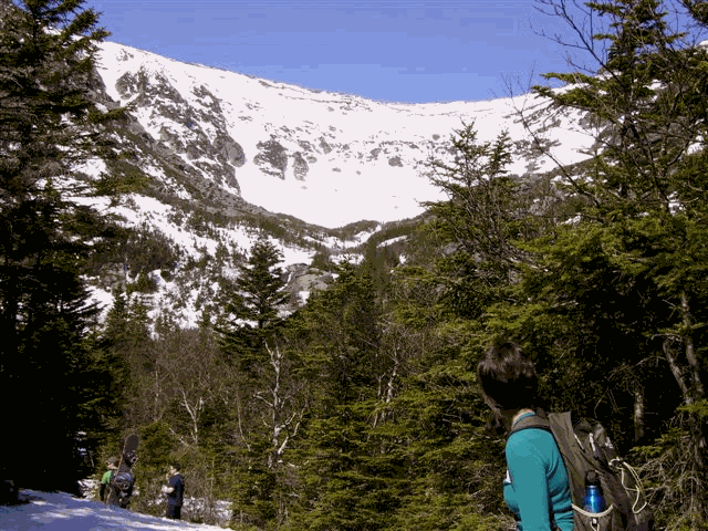
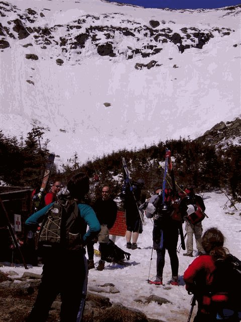
There’s still a lot more climbing to the bowl.
Finally, the objective:
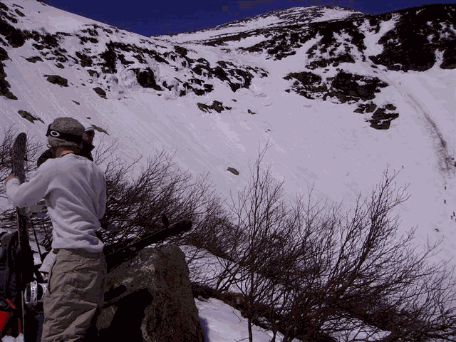
Kelly and Alison claim a rock:

The same rock as seen from the base of the Left Gully ski run. Wave to the camera!
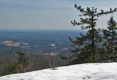
About half way up, looking across the ravine Can you believe that this is New England?
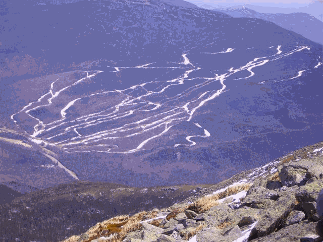
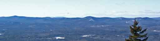
A view from the top – Ski Wildcat across the notch.
Fresh tracks dropping into the chute. Right about here, it started getting cold – the snow is getting a little crusty. Recognition of reality starts to trump bravado as people who climbed the last 300 yards focused on footholds and handholds in the snow directly in front of them and who had not looked over their shoulder since "that guy right in front of us lost his footing and slid down out of sight without saying a word" felt a prickle of vertigo. The word came up the line a little later that "that guy" was ok. No harm and somehow we each feel a little less vulnerable.
The "Headwall" is just visible in the picture above in the extreme lower right. Today, it had real crevasses extending most of the way across it and all were being encouraged to NOT attempt it.
Pictures completed, skis were strapped on and 10 minutes later, a good portion of 3 hours of climbing had been obliterated. Alison and Kelly had been witness to a good number of great runs, great falls, serious sun and perfect bluebird weather in the bowl and were ready to take their memories down to the valley.
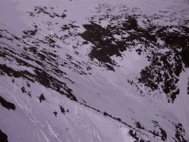
A turnaround look at Hillman’s Highway and Lower Snowfields on the South side of the ravine.
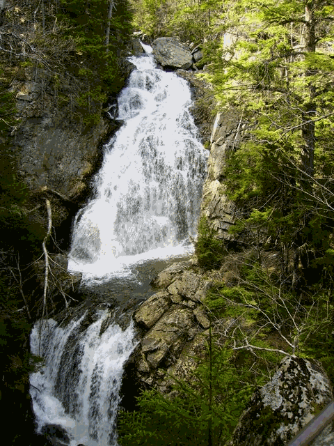
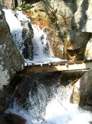
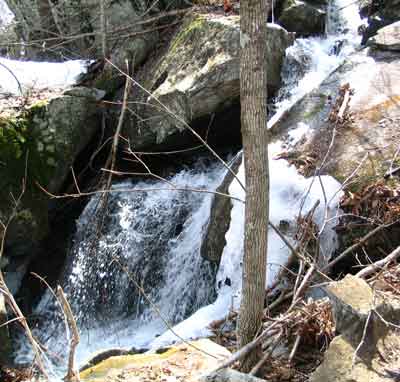
Much further down, after the snow disappeared, Alison took us on a side path to a great waterfall. Does anyone have the name?
And then we were back down. Weary bodies, uplifted minds and at least one of us said "Let’s do this again next year."
|
|
North Pack via Ted's Trail and Wapack Trail - March 20, 2010
Activity, photos, and report by Ken L.
|
 |
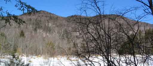
Stunning March weather for a hike!
Good thing the weather was very warm and sunny, as there
was snow at the trailhead for Ted's Trail. And that could mean
only one thing...
Hmmm...The snowshoes were safe at home in the garage.
Well, maybe the snow won't be so deep. Or maybe the trail would be
packed down. Yeah, no problem. Ahem. |
The brook near the trailhead and Ted's Trees looked peaceful
enough...not much water, not much snow...
...but the brook and the waterfall were quite busy...
...and the bridge had been knocked out of place and was not
usable. So Your Webmaster decided to try to cross on a big, sturdy
log...
...yes, that one, the broken one, which wasn't broken when
he started...
|
 |
...so it's a good thing it was really warm and quite
nice that day. After dumping out his boots, Your Webmaster wandered on
further.
 |
The snow at that point was becoming difficult. There
would be patches without snow and snow that had some packing, but there were
spots with deep snow and some post holing. And I was only about half
way. Not far from where the trail leaves the stream, another hiker who
started up the trail just before I did came down. He said that the
trail above was not broken, and there were drifts. He decided that
he'd had enough and turned around.
Not being the brightest hiking boot in the trunk, Your
Webmaster decided to head up to check it out. Sure enough, where the
other hiker's footprints stopped, it was pretty much a dead stop.
Barely discernible in the snow were snowshoe tracks from
maybe two weeks before. So there was unbroken trail, several feet of
melting snow, and still almost half the hike left to the top. Of
course there were options at that point. I could go home. I
could "man up" and slog on through. Or I could sit there crying for a
while.
After I wiped my tears, I began the stomp. The snow
was wet, so each footstep into the deep, unbroken snow was stomped three
times, then a test, then step up, pull back and stomp again if the snow was
post holing, then repeat...step after step.
Surely there wouldn't be nearly as much snow as the trail
went around to the cliffs facing south in the sun!
Errr...No.
Your Webmaster continued on...stomp, stomp,
stomp...test...re-stomp...repeat...for quite a way. OK, surely at the
South Cliff the trail would be packed down...all I had to do was make it
that far, then I could easily get to the summit and head down the Wapack...right?
|
 |
Finally - the trail junction for the South Cliff! And
more unbroken trail.
Stomp, stomp, stomp...test...re-stomp...boots filling with snow and
water...until...
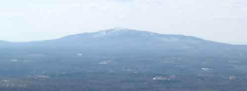
Lunch on the South Cliff, with its nice nice view of
Monadnock. The squishy boots came off, and I did what I could to
dry off the feets in the warm sunshine. |
From there, no problem to the summit, right? BZZT.
Two people had been by at some point to break trail, but it was still a
slog!
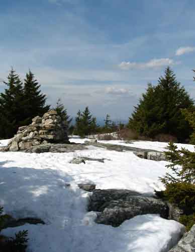
Then---finally---the summit cairn.
After lazing out for a while on the granite slabs not far
from the summit along the Wapack, it was time to head down.
The Wapack was a bit more packed down than Ted's Trail---and
Carolyn's Trail for that matter, which had nobody on it for months and was
probably underwater near the bottom. It was a much speedier walk along
the Wapack, with the assistance of some Microspikes.
Mountain Laurel ready for spring!
Then it was a walk along the road back to the car. Yay--no
more snow!
Not bad for the first day of spring 2010...Hiking through
snow, some great views, hiking through more snow, very soggy boots...but a
very happy hiker! |
X-C Ski at Windblown - March 7, 2010
Activity, photo, and report by Ken L.
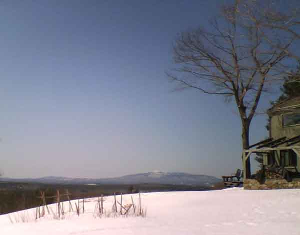
The view from the owners' home at Windblown
Beautiful, warm, sunny weather...and plenty of snow left!
Windblown X-C Ski Center is
located in New Ipswich, New Hampshire. With miles of trails--some very
difficult--over a variety of terrain, nice views, a lodge, lessons, and
more, it's a great "nearby" place for a lot of us in Massachusetts and
surrounding areas to get in some cross-country skiing.
The week previous to this activity Windblown had moonlight
skiing. Your Webmaster was amazed how little snow there was on the way
to Windblown, yet it immediately jumped to more than a foot along the road
as the altitude changed. Sure enough, at Windblown there was plenty of
snow, and the moonlight skiing was excellent.
Your Webmaster spent the morning on the trails and met up
with Diane and Cathy from the moonlight skiing evening for some more X-C
during the afternoon. Cathy decided to try the more adventurous stuff,
so Diane and I spent a few hours on the greens and blues.
An excellent day, a fine cross-country ski area.
Note that the future at Windblown is uncertain; the area
is for sale. We'll see what happens next winter! |
Crotched Mt. - February 7, 2010
Activity, photos, and report by Ken L.
The hike that almost wasn't...
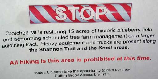
The Crotched Mt. trail system in the
Crotched Mt. Town Forest is getting a facelift, and the usual trail,
Shannon's Trail, was off limits. So what next for our group of anxious
GONewEnglanders who were ready for a walk in the woods to the summit of this
2000-footer?
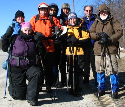
Kathy, Sara, Arnie, Pam, Randy, Joyce, Your Webmaster,
Egils
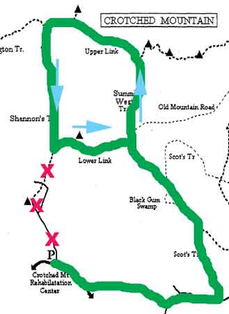 |
Fortunately Your Webmaster had been in there years ago
on a different trail to the east...but didn't quite remember where it
was. The trail would get the group around the closed off area, but
would we be able to find it? Well, of course!
Our newly plotted route had us jump over a guardrail onto an old town
road. From there we made our way to a left hand turn onto Scot's
Trail. We took the Summit West Trail to the ridge and turned left
to the overlook where there are great views of Mt. Monadnock and into
Vermont.
From there it was down the top part of Shannon's Trail, over the
Lower Link, and back.
There was a bit more hiking to do, but it's worth noting that as soon
as Shannon's Trail opens again, there will be a nice loop. It'll
be even longer if you head east along one of the other trails and go up
over the ridge (we opted not to do that).
Some of us put on snowshoes at the start of the trail,
while others made do with hiking boots. Generally the trail had a
little bit of granular snow on the top and a little bit of ice, but it
was walkable. The poles helped! |
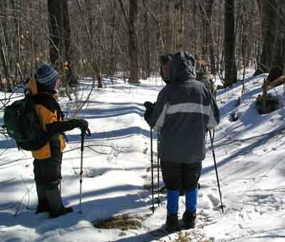
Brrrrrr! Although it was sunny, it was a typically
cold winter day, and it was a bit windy.
Along the way we stopped for some nice views and some lunch
in the woods along the Summit West Trail. This was in the sun and out
of the wind.
The views into Vermont from the overlook near the summit
were nice as always, but the wind was up. So we didn't pause too long
and made our way down Shannon's Trail.
Pam and Randy heading down from the overlook
It was a bit icy as we made our way down. Pam put on
her crampons, and I threw on my YakTrax, which sufficed.
We reached the Lower Link junction, and it was there we
realized what the work on the lower part of Shannon's meant to the terrain:
(click for a larger image)
The area in the picture was fairly wooded last year.
Much of the lower part was young evergreens, and there was one spot of
"spooky woods" which was great to walk through. I do not know if the
"spooky woods" are still there--I hope so! We'll have to see when the
trail is open again.
 |
Not wanting to stray onto the closed trail, we turned
left onto the Lower Link. It was then we hit the snowy trail!
Sheltered from the sun on the leeward side of the knoll, the granular
snow piled up, and although someone had been through on snowshoes, it
still wasn't all packed down like the rest of the trail we took.
So we had a bit of a slog through that area.
Kathy pauses near the area of tree management
along the Lower Link Trail |
Once back to Scot's Trail, we turned right, then right
again on the old town road to head back out.
We arrived at the paved road just as the sun was nearing the
horizon.
Update from Kathy K.: In addition to the restoration of the
blueberry fields and tree management, there's work in the Crotched Mt. area
to create accessible nature trails. Click
here
for more information.
|
Boxford State Forest - January 24, 2010
Activity, photos, and report by Ken L.
Additional photos by ArnieUh ohhhh...
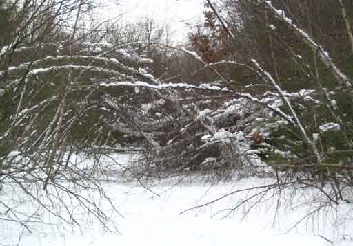
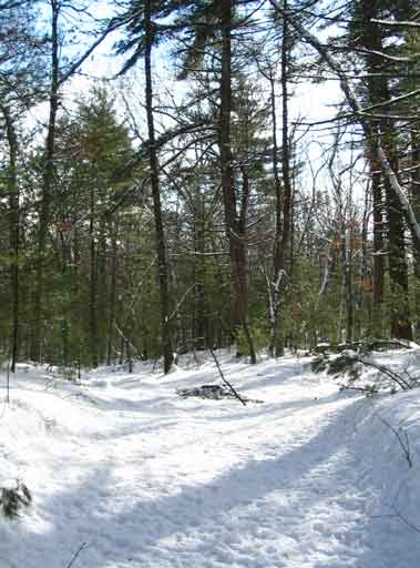
Yes, that's the trail from the parking lot at the
end of Sharpner's Pond Road.
 |
So that was the scene which greeted Your Webmaster and
Arnie as we set out for a bit of a walk at the Boxford State Forest, a
few hundred acres of state land not far from Interstate 95 on one side
and Route 114 on the other up there in Boxford, Mass. Largely
undeveloped, we weren't shocked to see the trail in turmoil with the
snow-downs. In fact, that's part of what makes Boxford a great
place to visit--nobody is out there putting up information kiosks,
putting in public swimming pools, dragging in picnic tables, or charging
an entry fee.
Our first order of business was to bushwhack around the snow-downs!
Arnie does product testing and is trying out
the snowshoes on a bushwhack |
...and to our amazement:
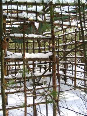 |
We ran into a shelter or hunting blind frame made from
saplings and nails and screws. The tarp on the roof wasn't tied
down, but that's easily fixed (once it thaws and the chunks of ice in it
are gone). There was a nice little chair in there to rest the
bones, too, and a spot for a fire. Nice! Back out on the trail,
Arnie and I discovered we were just about the first through, even though
the snowfall had been there for a while.
No tracks
It's rather unusual to have snow without tracks of some
sort, but that's OK. (What looks like tracks in the picture are
chunks of snow and ice from the tree branches overhead.) Arnie had
snowshoes, and I had my boots--the snow was mostly crunchy/icy and
sometimes powdery. Cross-country skis probably wouldn't have been
the best choice. |
The bridge by the beaver pond...
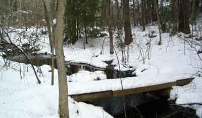
...and the big ol' tree...
...were still there to greet us.
At the cemetery we ran into a Hiking Meetup group led by
GONewEnglanders Dawn and Bill. Dawn and Bill decided to have a
snowshoe starting from the other side of the Boxford State Forest, and Arnie
and I heard them crashing through the woods as we sat having a snack at the
cemetery.
Sitting at the cemetery saw the sun ducking behind the
clouds and the temperatures lowering a bit, so Arnie and I decided to head
back out to the cars. Even with the slight chill, it was still a nice,
quiet day in the woods.
The trees paid appropriate homage to Your Webmaster before
he exited the Forest. |
|