Joe English Hill Reservation - Oct 27, 2001
Activity by Pam Fortier
Pictures/Game by Ken Leonard
Trip report by
Pam and Ken
| It was a perfect fall
day...with just a bit of chill in the air, sunshine and blue sky, for
a delightful hike on a trail that was blanketed in colorful leaves... |
Fall hiking. It just doesn't get any better. Cool days, nice
colors, no bugs.
Diane, Pam, Jack, Your Webmaster, and our Black Lab friend
Shadow decided to check out the Joe English Hill Reservation in Amherst,
New Hampshire. It's right off Route 101 (take Horace Greely Road to
Brook Lane).
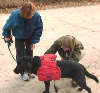 |
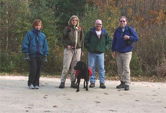
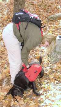
Dogs are welcome, so, of course, we just had to bring Shadow
along. He carried his own pack, wriggling out of it just once
during the day.
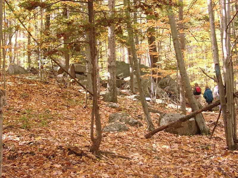
| Four of us hiked along
with Shadow who was wearing his pack and leash reluctantly. |
|
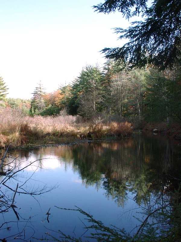
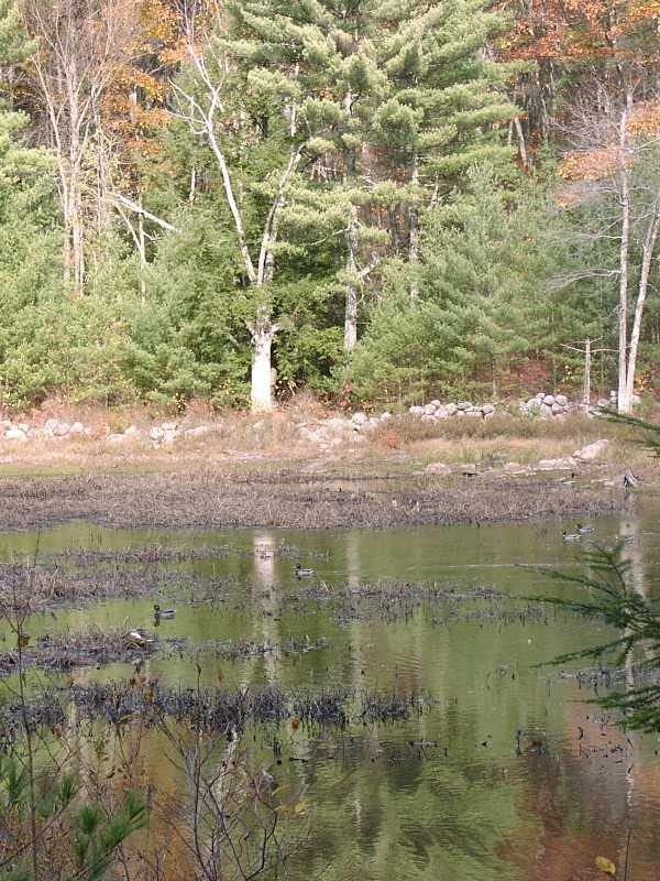
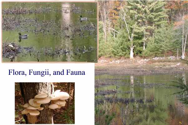
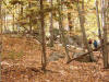
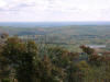
The Reservation is a series of trails in conservation land. Joe
English Hill itself is only about 400 feet, so you don't go there for the
view!
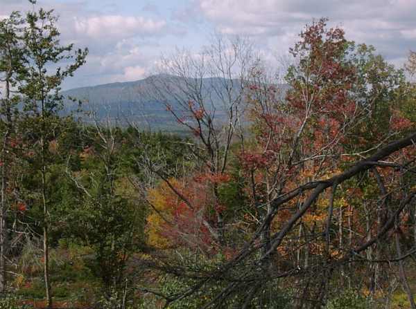
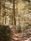
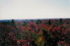
| The paths were
varied...forest of maple, beech, birch, and oak...some with mountain
laurel on both sides of the path, a brook and pond previously
inhabited by beaver, now a spot for ducks.
With all the leaves on the trees and some
cases and on the ground in most cases we had to pause to find the
trail markers. |
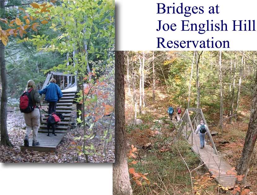
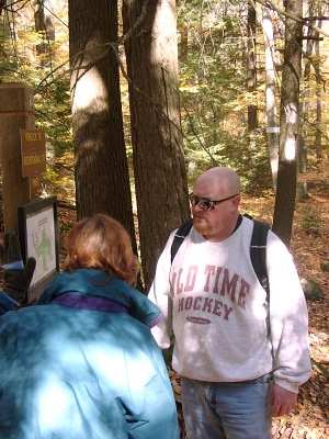
But it's a nice trail system, and, as you can see Diane
and Jack studying in the picture below, it's very well marked with trail
signs and full color maps at each trail intersection. Bravo,
especially since none of us had ever been there before.
But, yes, despite all those markings, we did scratch our
head now and then. Hey, it's easy to lose your direction a little
when all you have is woods...and when all the trails are covered with
fallen leaves!
Help us find the trail in all those
leaves! Play The Trail Game!
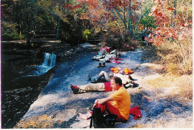
| After wandering for a while (our original "two hour
or so" hike eventually turned into four hours), we paused for lunch
in a nice section of woods.
 |
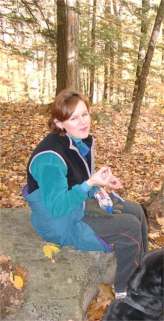
OK, Diane, I won't take another picture of you
while you're eating. (Not until next time anyway.) |
Shadow liked rolling in the leaves whenever we
stopped!
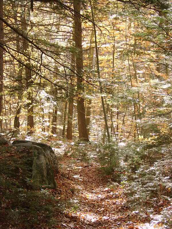
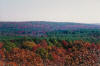
On the way out we passed a beautiful fall scene.
 Boy, I wish I could bottle that up and take it with me, but the best I can
do is a picture. Yeah, fall hiking rules! Well, fall
hiking is great, except maybe for the leaves on the ground, which can be
slippery underfoot. And they hid the trail really well! Give
us a hand finding the trail---just click here
and see how well you do!
Boy, I wish I could bottle that up and take it with me, but the best I can
do is a picture. Yeah, fall hiking rules! Well, fall
hiking is great, except maybe for the leaves on the ground, which can be
slippery underfoot. And they hid the trail really well! Give
us a hand finding the trail---just click here
and see how well you do!
After our nice walk through the Reservation, we made our way to the
Black Forest Cafe right down the street for a snack. Yummy stuff!
Jack took off afterward, but Pam, Diane, and Your Webmaster made it to
Club Day at a certain Emporium for More Supplies in Manchester and then
out for some dins. It was a whole day of GONewEngland style fun
including everything from trails to, of course, FOOD!
| This hike has much promise
for snowshoeing this winter with a nice sunny spot to lunch at Lookout
Rock. |
As long as they plow the little parking lots, the Joe
English Hill Reservation should be great for snowshoeing and X-C skiing.
Let's keep that in mind as the snow starts flying, 'kay? :-)
|
Halibut Point Walk - October 27
Activity/Trip Report by Janis Giles
Photos by Dawn S.
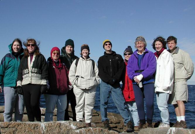
Dawn, Michelle, Patty, Don, Jen, Chris, Tanya, Jan,
Linda, Alan
Ten of us, including some brand-new GONewEnglanders, braved the cold
and wind to check out Halibut Point near Rockport, MA. Most of the group
had never been here before. It was a pleasure to introduce people to such
a beautiful spot that takes much, much longer to drive to than to walk
through. :-(
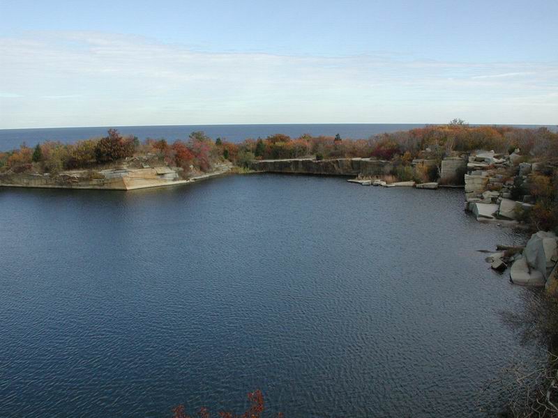
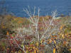
After walking through a tunnel of trees and briars, we headed into the
open and around the quarry.
 Halibut Point offers a self-guided tour that gives the history of the
quarry and points out artifacts left from the days when granite was
hoisted out. We made our way down to the ocean's edge.
Halibut Point offers a self-guided tour that gives the history of the
quarry and points out artifacts left from the days when granite was
hoisted out. We made our way down to the ocean's edge.
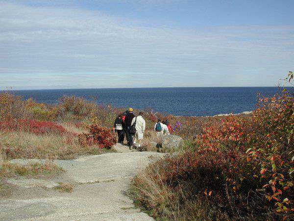
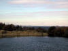
 From there, we headed back uphill to a lookout point built on an enormous
pile of discarded granite. From there, you can look out to Crane Beach,
New Hampshire, Maine, and the Isle of Shoals. Since the day was clear, we
had a good view, but even the birds wanted to stay out of the stiff
breeze.
From there, we headed back uphill to a lookout point built on an enormous
pile of discarded granite. From there, you can look out to Crane Beach,
New Hampshire, Maine, and the Isle of Shoals. Since the day was clear, we
had a good view, but even the birds wanted to stay out of the stiff
breeze.
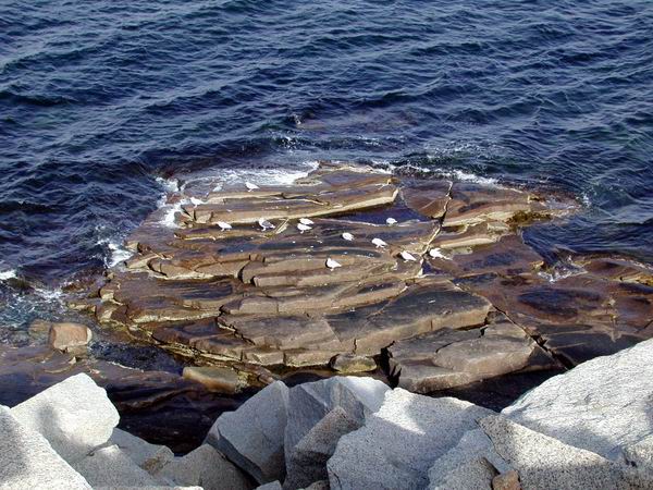
From the lookout, we walked down to the ocean again, then up to a
little area featuring granite carved into bollards and more exotic shapes.
Patty found them irresistible.
Finally, we headed up into a tower which was used as an antiaircraft
spotter in WWII. Since the top of the tower is closed to the public, I
wonder if they still use it for such? We got a fabulous view of the area,
and visited their museum which features, among other things, a berry quiz
and stuffed birds. It's a beautiful, peaceful spot.
For a short time, additional pictures may be found
here. |
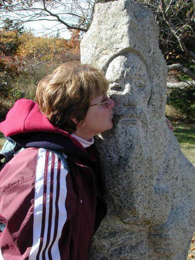
Haunted Hike #1 - Oct 21, 2001
Activity, Report, Photos by Jim "The Ump" P.
| I had
thirteen terrific people accompany me for Haunted Hike #1 at Arcadia
Management Area in Exeter, RI. The foliage was at its peak, the
weather was outstanding, and the haunts were spooky.
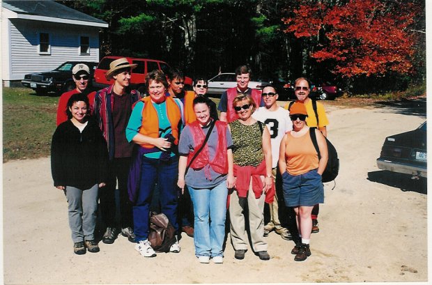
Here we are, ready for
our long journey,
wearing our orange so we aren't mistaken for a flock of water fowl.
Behind us is the Old Exeter Baptist Church.
We all met
at the Old Exeter Baptist Church. It's an old 18th Century New
England meeting house. A perfect setting to begin our creepy trip.
We all had to wear orange, because bird-hunting season had opened
the previous day. I told the group that we had little chance of
seeing a hunter. I would eat those words.
Our 10-mile
journey began on the Mount Tom Trail. It's a lovely walk through an
immense dark and dense pine grove. Of course, we also met a hunter.
I must admit, his etiquette was superb. He had his barrel collapsed,
and he was cradling it in his arms - textbook! Some guys do it
right.
Further
along we would encounter some enormous ant hills. Some were as big a
Volkswagons! There was not an ant in sight. They were done with
their work for the winter. Still, I noticed an extra hop in
everyone's step going through the Antropolis.
We scrambled
our way up a rocky outcropping, and we were treated to a glorious
view of the foliage. Roy and I snapped our cameras, while Mike and
Ben eagerly took my binoculars to inspect the uninterrupted view of
forestland. It was an awe-inspiring sight.
We scrambled
our way to the end of the outcropping, and then crossed Rte. 165 to
summit Mount Tom itself. At a measly 430 feet, covered by a thick
canopy of hardwoods, it wasn't all that impressive a Mount. In fact,
if there wasn't a wimpy looking rock outcrop at the top, you
wouldn't even know where the peak was!
 |
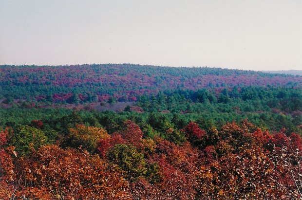
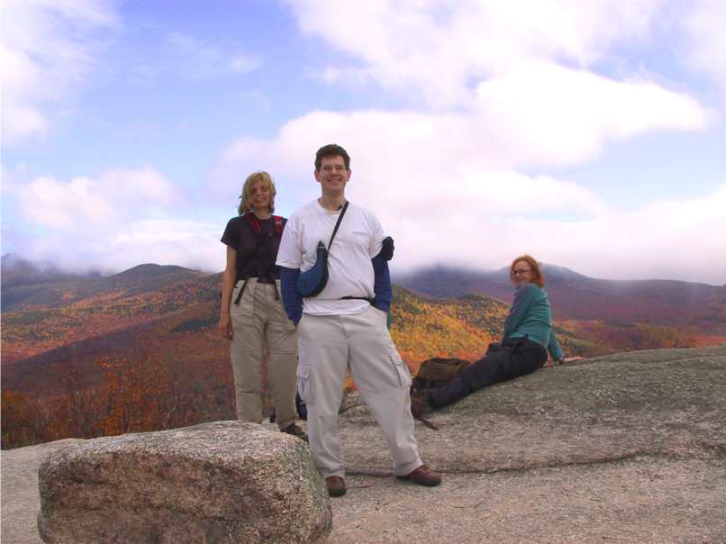
(Left) Our
first view from the summit along the Mount Tom Trail. Can you
believe that's little Rhode Island?
(Right) Another
beautiful view from the summit. Splotches of reds, oranges,
and yellows can be seen mixed among the mighty dark green
pines. We soaked in the view for a good, long while. I even
passed around my binoculars. |
 |
After
walking down a long and straight path arched by Mountain Laurel, we
eventually came out to a dirt road, where we had to change to the
Escoheag Trail. This part of the journey was quite lovely. After
winding through a dense hardwood forest, the path meandered silently
through an impressive pine grove. These trees were much taller than
those on the Mount Tom Trail. The silence was deafening as we
cowered beneath the towering giants.
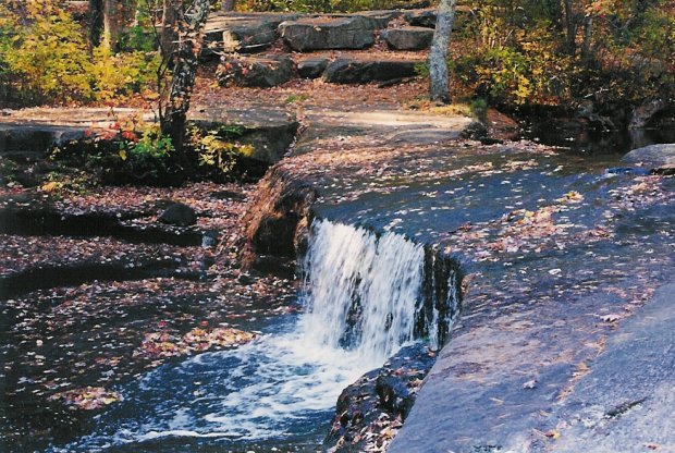
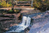
From there,
we made our way to the Ben Utter Trail, which runs beside Falls
River traveling upstream to Stepstone Falls. Although the water
level was low, the beauty of the area did not disappoint. Bill was
fascinated by the mill ruins and old stone dams, but everyone else
seemed more interested in getting to the falls to have lunch! At
almost six miles into our journey, who can blame them?
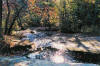 |
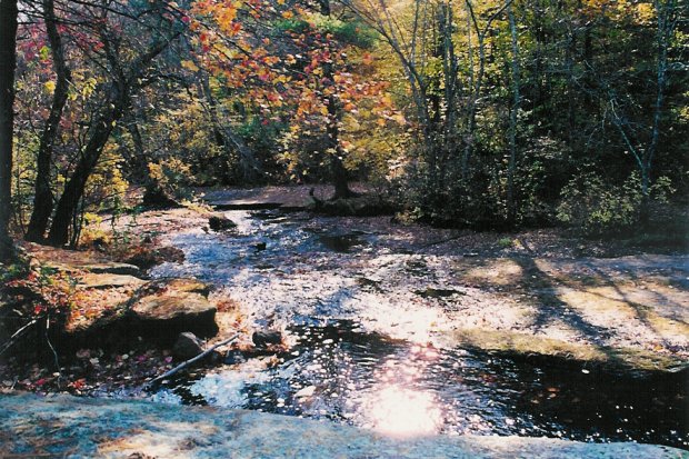
(Left) There
is Falls River looking a little low. Pretty at any time of
year, Stepstone Falls is an old, deserted picnic area. Once
very popular in the fifties, only ghosts remain today.
(Right) One of the
many "steps" along Stepstone Falls. |
 |
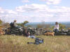
We ate lunch
beside the falls, and once again Roy and I started pointing our
cameras. A few of us took off our boots, and some even stuck their
feet in the soothing waters. It was very relaxing. A perfect time to
catch a second wind.
 |
There we all
are digesting our food, and resting our weary feet. And to
think we were only halfway home. But we all survived it, and
what does not kill us, only makes us stronger. |
After lunch
we were on our way again. We headed back the way we came down Ben
Utter Trail to pick up Shelter Trail. Before taking the fork we
noticed that Shannon had aggravated an old injury and was in a bit
of pain. Bill offered to accompany her on a shortcut back to their
cars. And off they went. I must say, Shannon was a trooper. She kept
right on trucking. That's courage.
The rest of
us pressed on, and found our way to Shelter Trail. We took it slow
going up Penny Hill, our last to conquer. At this point, around mile
8, we were a pretty battered group. Everyone continued laughing and
having a great time despite the blisters, fatigue, and soreness.
I was
speechless when one of our hikers announced that she had filled her
water bottle at Falls River, and she had been drinking that!
Although she feels okay now, there is great danger in drinking
unpurified water from a brook, stream, or river. Giardia is a nasty
parasite that you don't want. DON'T DO THAT! She knows that now. It
is very important that you bring plenty of drinking water when you
hike. One Avian bottle is NOT enough.
It was
getting dark, and the stronger folks in the group offered to forge
ahead to get their cars to come back and pick up our battle wounded.
A few folks
admitted to having under-estimated 10-miles. It is a long distance
hike. But despite the great adversity, despite it all, everyone had
a terrific time. No one complained about anything. They talked and
laughed the whole way through. Haunted Hike #1 was a tremendous
success!
Now, I want
y'all to know that I've left out of this report all of the spooky
tales that accompanied this hike. Would you be interested in hearing
them? You'll have to come next year. |
|
Welch-Dickey - Oct 14, 2001
Activity/Photos/Trip Report by Martin Kessler
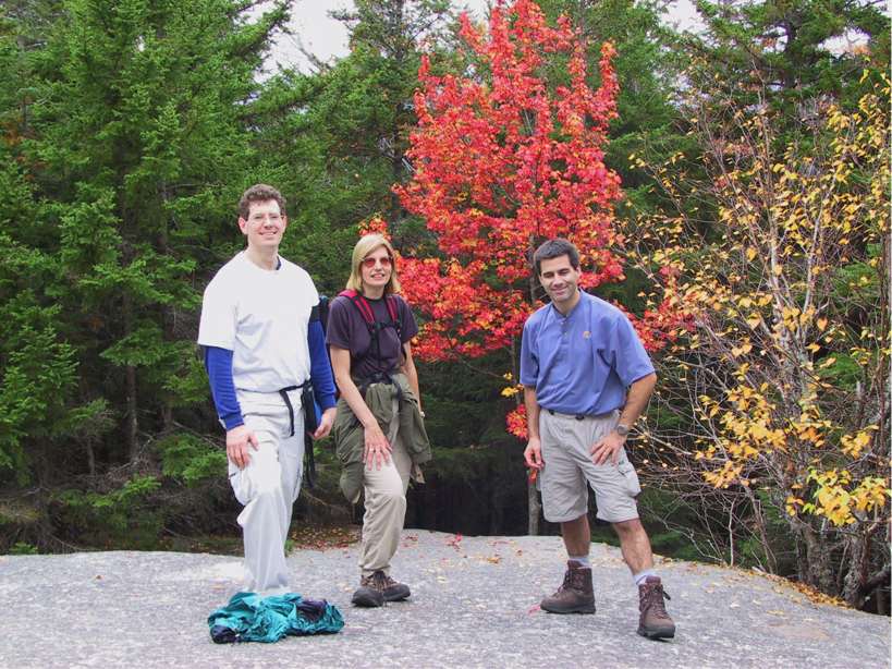
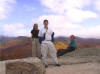
A small group of four hikers got together to
enjoy the fall foliage around Mts. Welch and Dickey.
At the first outlook Pam, Sheldon and Eva are
above a valley with spectacular red, orange and yellow trees.
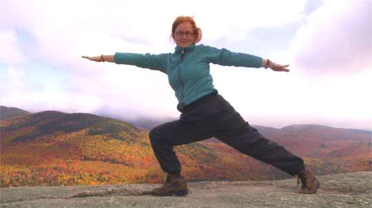
Eva surprised us with Yoga moves �warrior
two�.
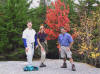
Sheldon Pam and Martin in front of a fire-red
tree.
We all had a great hike, with some luck that
it stayed dry.
|
Galehead Hut Stay - Oct 13-14, 2001
Activity/Trip Report by Tom Sweeney
| October 13, the last day
the full-service AMC High Mountain Huts are open. Must be because it
gets cold in October in the White Mountains, eh? WRONG, polypro
breath! Saturday October 13 was bee-yoo-tee-full.
Annette S. and I met Dave K. at the
Garfield Ridge trailhead promptly at 8:45. GONewEngland Welcoming
Committee/Motivator Kathy K. soon arrived, and we did the car
shuttle dance. We left Dave's car where it was, put Kathy's car at
the Gale River Trail trailhead, and we all drove in my van to the
Twin Mountain trail. Thien N. had to cancel due to illness and John
R. was going to start a bit later.
We hiked up North Twin in shorts and
T-shirts, and when we got to the top, we laid down on the warm ledge
to rest. I didn't fall asleep--whatever snoring noises Annette and
Kathy heard must have been a bear. Dave had moved on ahead.
By the way, on the way up North Twin, we stopped to talk to a hiker
coming down. After a few minutes of chatting we made introductions.
It was Bob Williams, fellow GONewEnglander who'd attended my
Tuckerman hike last April. (He went all the way to Mt Washington
that day). He'd been busy. A couple of weeks ago he planted a huge
American flag atop Mt Liberty.
Anyway, Annette, Kathy and I tried to catch Dave, to no avail. We
went over South Twin and down the Kamikaze Slope (a knee-popping
1200 foot drop in about three-quarters of a mile) to the foot of
Galehead Mountain, and then we were at the hut.
Nice dinner, nice bunks, nice crew, incredibly clear night sky with
a milky way almost pure white and shooting stars everywhere.
Breakfast was yummy and, like dinner, it was prepared for us by the
crew and was all-you-can-eat. The weather cooled off a bit in the
morning. We went up and down Galehead, then headed down. Ironman
Dave went over Garfield Ridge to summit Garfield, while the rest of
us mere mortals (Annette, Kathy, John and myself) went down the
lovely Gale River Trail. Brilliant blue sky, impossible green moss
and spruce trees, bright yellow and red leaves, and a trail by the
rushing Gale River. This was a hike I won't soon forget.
Then, suddenly, we were down and it was collect the cars and off to
Bill & Bob's BBQ in Lincoln. My only regret of the weekend was that
I was halfway home before I realized that I wanted to stop at the
hikers bookshop in Lincoln (run by Steve Smith) and buy his latest
hiking book. Ah well, guess I'll have to go back, won't I?
|
|
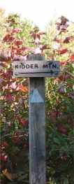 |
Kidder Mt. - Oct 7, 2001
Activity/Photos by ...kl...Not all photos are
full-size! Click on the thumbnails (small photos) to see a
larger picture.
Fall hiking doesn't get any better than this. Bright sun, a
few clouds here and there, temps in the 50s-60s, a bit of a breeze
that wasn't too much...And, of course, some fabulous GONewEnglanders
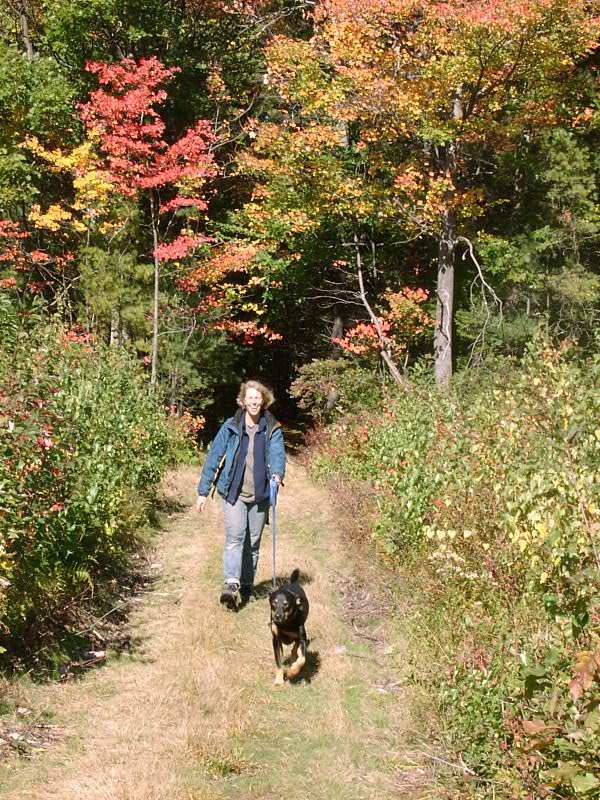
and a few puppy pals along.
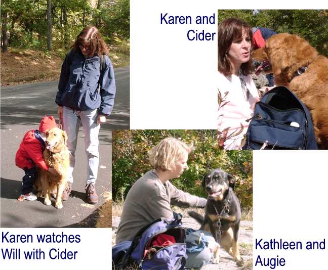
As usual there were folks I didn't know, including Karen (and
Cider), Donna, and Kathleen (and Augie). Oh, right---li'l Andrew
Cronin, just 6 weeks old---nice to meet you, too, Andrew! :-) |
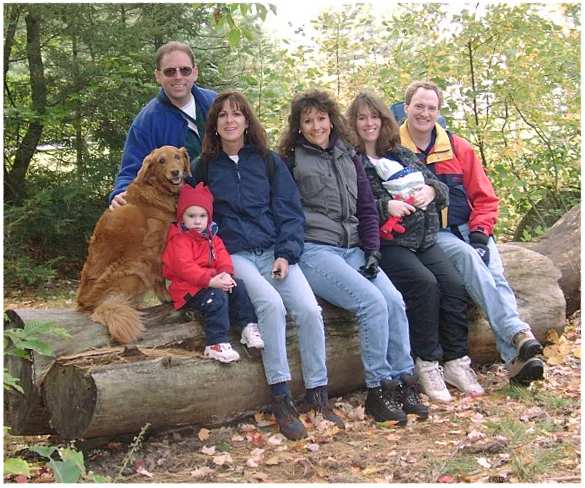
Your Webmaster (in back), Cider, Will, Karen, Donna,
Tammy (and Andrew snuggling there), Mike...
 |
...and Kathleen and Augie, who didn't make
the group shot but were along for the hike |
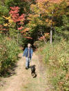
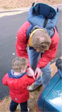
| Daddy Mike got Will all bundled up for the hike, and off we
went. Will made it for about 1/3 mile, and then it was time
for him to hop into the carrier where Mike had him piggy-backed the
rest of the way. Our canine friends
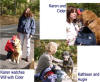 had no problem at all with the hike. Both Augie and Cider were
very friendly. You'd expect that from Cider, a Golden
Retriever. Augie Doggy is more of a mix, with coloring akin to
a Rottie, but it's suspected he's mostly Lab. Great hiking
companions!
had no problem at all with the hike. Both Augie and Cider were
very friendly. You'd expect that from Cider, a Golden
Retriever. Augie Doggy is more of a mix, with coloring akin to
a Rottie, but it's suspected he's mostly Lab. Great hiking
companions!
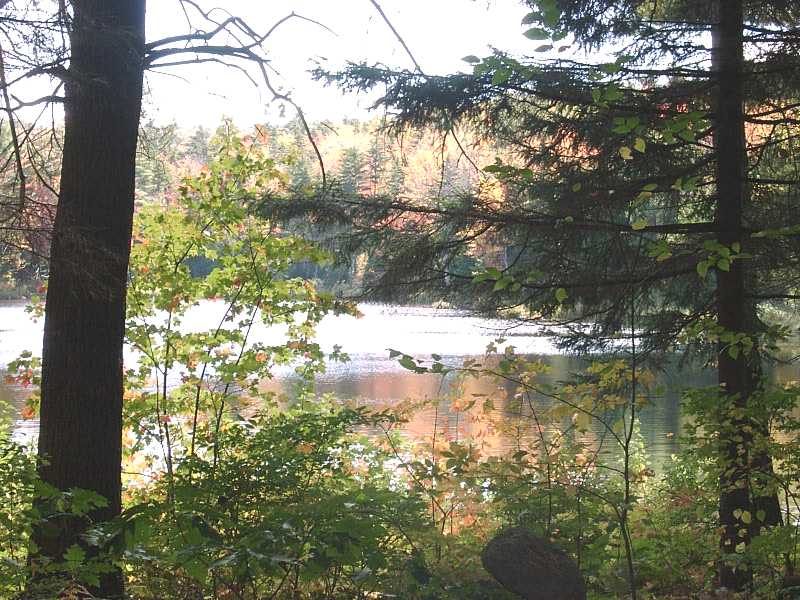
The trail is an old fire or logging road for about half of the
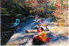
way. It passes a very pretty pond
 .
Ohhhh---how many times I've passed that way only to see the dock and
the canoes just waiting...But I digress. .
Ohhhh---how many times I've passed that way only to see the dock and
the canoes just waiting...But I digress. |
 |
|
 |
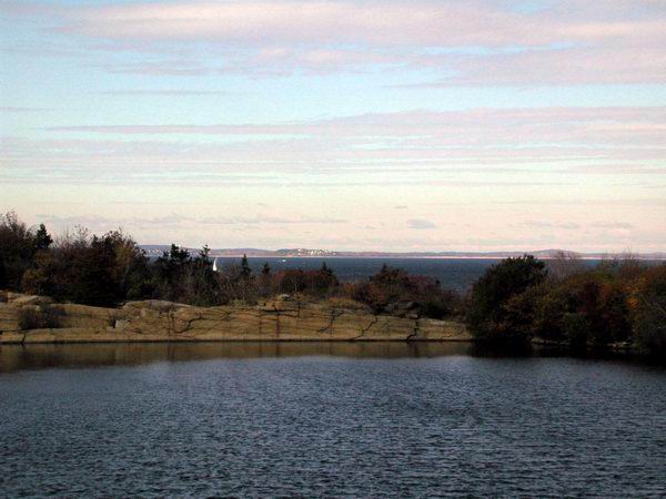
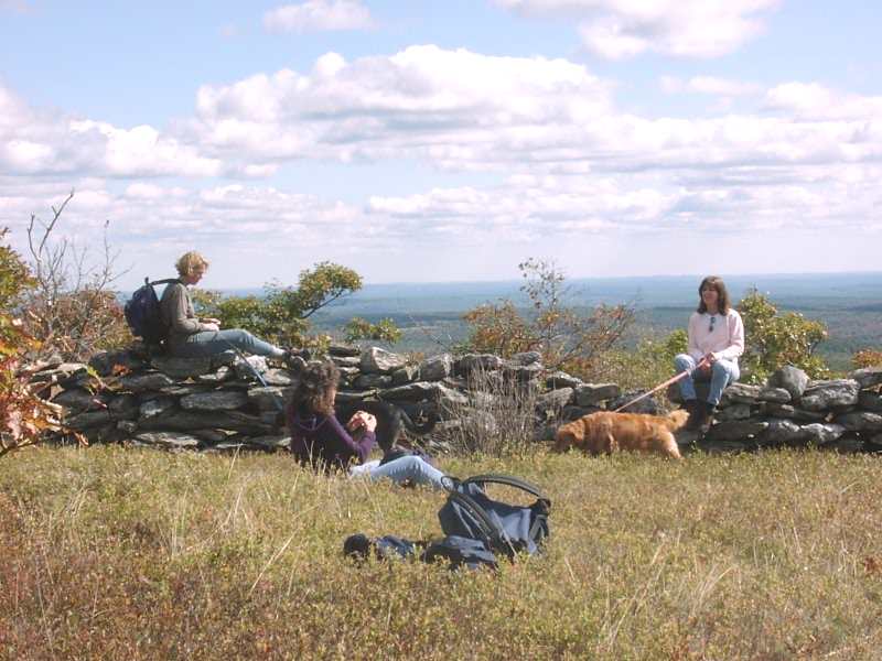
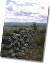
It didn't take all very long to reach the top. Just
remember to take a left after the power lines, and you're all set.
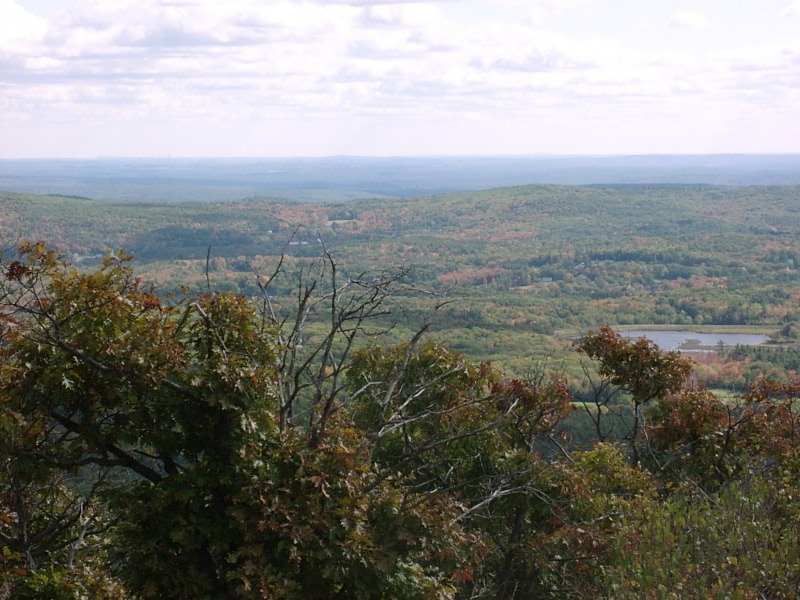
Kidder Mt. is an easy hike to a super view, that's for sure.
Although the foliage wasn't quite at 100% peak, there was still a
great deal of color down in the valley. And you could see all
the way to Boston on one side, and the other side gave a good view
of Mt. Monadnock.

At the top I guided the troop to the best sittin'
rocks, and we broke for lunch. Sunshine, nice temps, a tiny
breeze...Yep, a very worthwhile hike!
See you again soon, Kidder Mt.! |
|
|